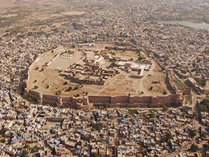
Glorified by the bards, the history of Nagaur finds mention even in the Mahabharata. The kingdom of Ahichhatrapur which Arjun is said to have conquered and subsequently offered to his Guru Dronacharya, was perhaps some of the area of theNagaur district. The birth place of Meera and Abul Fazal, Nagaur district has acharbhuja and Parsawanath Temple at Merta and the Dargah of Sufi Saint Tarkin atNagaur city. Nagaur also witnessed the valour of Great Rao Amar Singh Rathorwho challenged the mighty Mughal empire. The large old Fort has many glorious tales of bravery of the erstwhile rulers of the states. Nagaur District is situated between 260.25" & 270.4" North Latitude & 730.10" & 750.15" East Longitude. It is situated amidst seven districts namely Bikaner, Churu,Sikar, Jaipur, Ajmer, Pali, Jodhpur. Nagaur is the fifth largest district in Rajasthan with a vast terrain spreading over 17,718 sq. K.M. Its geographical spread is a good combine of plain, hills, sand mounds & as such it is a part of the great IndianThar Desert. The present district of Nagaur finds a place in the heart of the Rajasthan state. If we draw a cross over the map of Rajasthan the centre of this cross is bound to fall in the district of Nagaur. Before the merger of the states, Nagaur was a part of the erstwhile Jodhpur State. After indepenence, Nagaur had the honour of being selected as the place in the country from where the Democratic Decentralisation process was launched by the late Shri Jawaharlal Nehru, the first Prime Minister of India on the 2nd October 1959. The town of Ladnu in the district has gained its place on the map of the country being the headquarters of the famous 'Jain Vishwa Bharti' which has become acentre of spiritual learnings & knowledge under the leadership of Acharya Tulsi, a great Jain saint, who has propagated the philosophy of "ANUVRAT" in order to enlighten people in this area of the country.
The district comprises of 1614 Revenue Estates (Villages), out of which Merta,Deedwana, Makarana, Parbatsar and Kuchaman are the major towns of the district. The total area of the district is 17,718 sq. K.M., out of which 17,448.5 sq. K.M. is rural and 269.5 sq. K.M. is urban. As per the 2001 census, the population of the district is 27,75,058 (4,77,337 urban and 22,97,721 rural population) which is 4.91% of the total population of the State. The density of population in the district is 157, as against 165 of Rajasthan as a whole. 12,87,921 persons of the district are literate, out of which 10,21,314 are rural and 2,66,607 are urban, which makes it 58.26% of the total population. Out of this literate population 75.33% are males and 40.45% are females.
Nagaur has a dry climate with a hot summer. Sand storms are common in summer. The climate of the district is conspicuous by extreme dryness, large variations of temperature & highly variable rainfall. The mercury keeps on rising intensely from March till June. These are the hottest months. The maximum temperature recorded in district is 470 C with 00 C as the lowest recorded temperature. The average temperature of the district is 23.50 C. The winter season in the extends from mid November till the beginning of March. Rainy season is of a short during from July to mid September. There are ten raingage stations, namely - Nagaur, Khinvsar,Didwana, Merta, Parbatsar, Makarana, Nawa, Jayal, Degana & Ladnun in the district. The average rainfall in the district is 36.16 cm & 51.5 percentage humidity.